

Galle
SL/S/GALL/M/21
MV Elsia · Ginthota Timber wreck
- Period
- Colonial - British
- Year sunk
- 1939
- District
- Galle
- Depth
- 9.00–12.00 m
- Vessel type
- Motor Vessel, Bulk Carrier
Overview
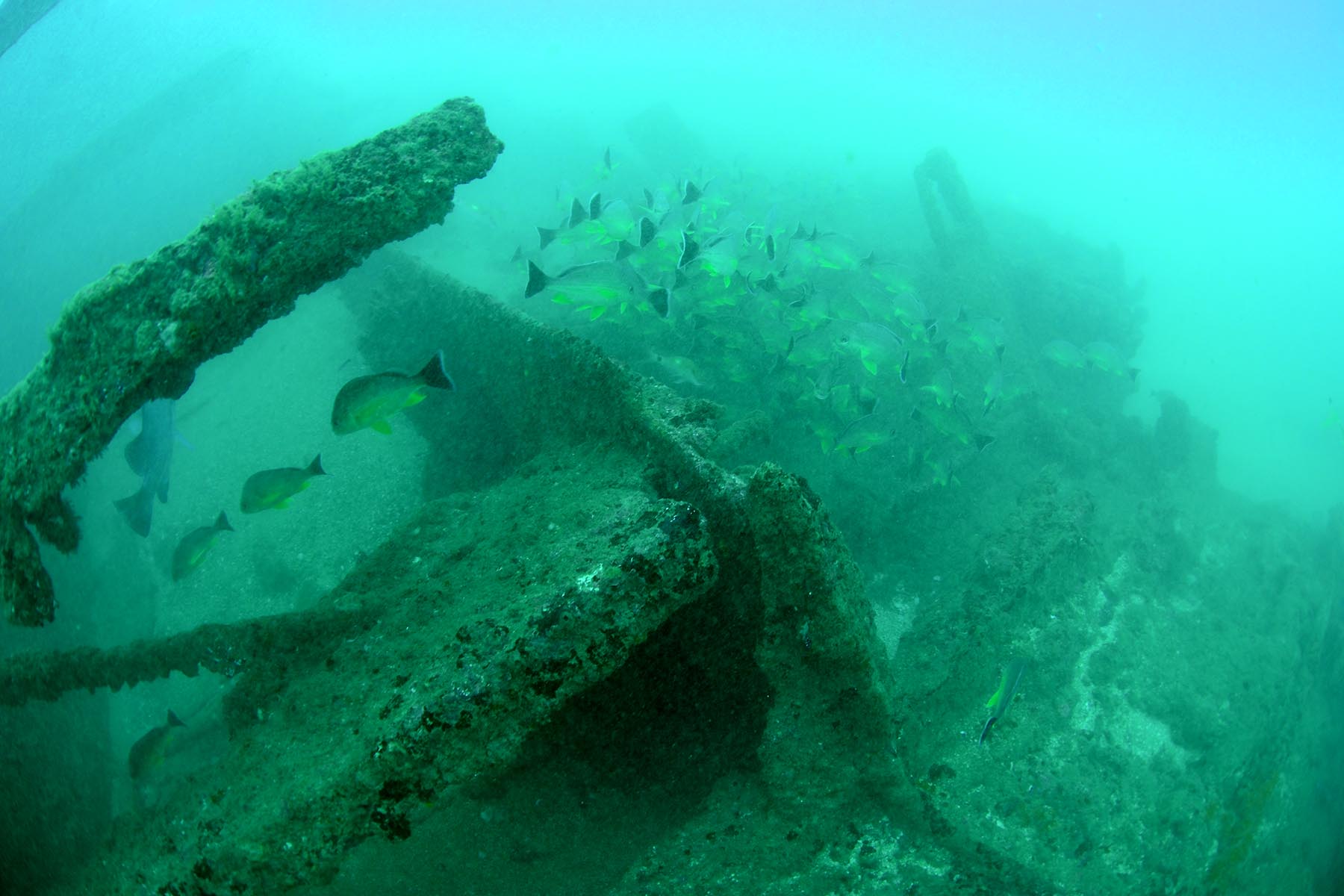
The wreck site was found during a line search done by the MAU in 2021. The shipwreck can be located 01 km south of the river mouth of the Gin River and 700 meters west of Dadalla Cemetery. The Northwest side of the wreck was found on the third day of the underwater survey (2021-02-20). The visibility around the wreck was very low and the survey team didn’t get an idea of the formation of the wreck.
Then again on the next day (2021-02-21) the other end, the Southeast end of the wreck was found. Again the visibility was so bad and it was very hard to get an idea of the shipwreck site. But some members of the survey team manage to go to the other end by following the wreck parts and find out the wreck is intact and nearly 100 meters long.
The sea condition in the survey area and especially around the wreck was getting worse during the next few weeks. The survey team waits till the end of March till the sea conditions get well. The fruitful dive operation was carried out on the 26th of March. The sea conditions were very good and the team did multiple dives to get the best of the day. The survey team went through the wreck a few times to get an idea of the formation. Then they start measuring and sketching the wreck site. It is a huge iron wreck long more than 100 meters. The wreck was intact and can identify from the bow to the stern. Yet most of the iron hull parts were salvaged, majority of the engine parts, hull and the superstructure were completely taken out as scrap metal. According to the local fishermen, the timber and the hull parts were also salvaged during the years 1990 – 2007.
According to the records, the ship sank in1939. It was known as MV Elsia a Danish cargo-passenger ship carrying a load of teak timber when it caught fire and sank. This info was in the book “Reefs of Thaprobane” by Arthur C. Clarke. Arthur and his companions dived on this wreck in 1956. There is a symbol of a shipwreck marked on the Admiralty sea charts close to the wreck we found.
Media gallery
·
Location
District: Galle
Province: Southern
Depth profile
9–12 m
Protection & status
- Access
- None
- Legal status
- None
- Archaeological value
- Low
- Physical protection
- None
- Threat
- Salvage
Vessel chronology
1939
Year sunk
Marine life at this site
-
Orange-lined triggerfish
Count: 2
-
Blacktip trevally
Count: 10
-
Indian vagabond butterflyfish
Count: 1
-
Vagabond butterflyfish
Count: 1
-
Minstrel sweetlips
Count: 1
-
Indian Ocean oriental sweetlips
Count: 1
-
Crown squirrelfish
Count: 1
-
Pink ear emperor
Count: 4
-
Spangled emperor
Count: 8
-
Common bluestripe snapper
Count: 15
-
Dory snapper
Count: 8
-
Whitecheek monocle bream
Count: 1
-
Onespot demoiselle
Count: 1
-
Bluering angelfish
Count: 1
-
Semicircle angelfish
Count: 1
-
Honeycomb grouper
Count: 1
Related shipwrecks
.jpg)
15 Km west Of Colombo
SL/W/COLO/M/07
- Period
- 1 st World War
- District
- Colombo
- Depth
- 50–60 m
.jpg)
17 Km west of Colombo
SL/W/COLO/M/15
- Period
- 1 st World War
- District
- Colombo
- Depth
- 35–40 m
.JPG)
06 km West of Negombo
SL/W/NEGO/M/25
- Period
- Colonial - British
- District
- Gampaha
- Depth
- 8–11 m
.JPG)
NSD-0039
SL/E/IRAK/M/01
- Period
- Colonial - British
- District
- Trincomalee
- Depth
- 6–9 m