

NSD-0041
SL/E/TRIN/M/04
SS Sagaing · SS Sagaing wreck
- Year sunk
- 1942
- District
- Trincomalee
- Depth
- 1.00–18.00 m
- Vessel type
- Iron Hull, Steam Ship, Bulk Carrier
Overview
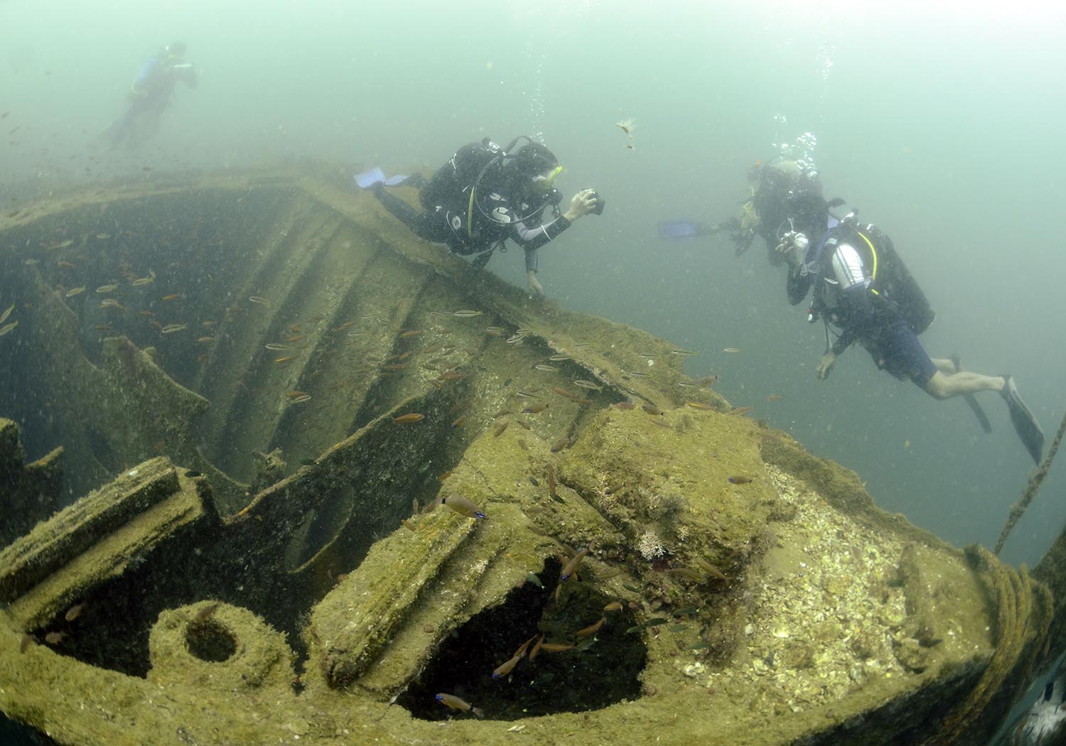
This shipwreck is currently positioned at a maximum depth of 18m, outside the Trincomalee harbour, west of Elephant Island. Constructed by William Denny and Brothers Company, SS Sagaing was operated by P. Henderson & Company (via the British and Burmese Steam Navigation Co.) starting from 13th March 1925. This iron vessel weighed 7994t and was 138.56m (454.6ft) in length and 18.65m (61.2ft) in breadth. The hull depth of the ship was 10.55m (34.6ft). Powered by three boilers with a single propeller, this steam vessel could reach a maximum speed of 13.5knots (nautical miles per hour). SS Sagaing could accommodate up to 137 crew on board. Although the service route of the vessel varied, the usual path was from Liverpool or Glasgow (England) to Rangoon (Myanmar).
SS Sagaing had been berthed in the Trincomalee Harbour when it was bombarded on 9th of April 1942 by a Japanese aircraft named ‘Kidō Butai’, during the World War II. Five (05) casualties were recorded onboard including, 03 crew members (the Quartermaster, a General Servant, Mussulijer) and 02 family members of the Junior Third Officer. Since a fire was erupted during the attack, the ship was drifted and settled at Malay Cove, where some of the cargo was salvaged during that time. The ship remained at the site until the 24th of August 1943, when the Admiralty purposefully sank her.
The position in which the SS Sagaing was sunk is presently located in the High-Security Zone of the Trincomalee Harbour near the Main Jetty of the Trincomalee Naval Base. Since the wreck was an impediment to development work at the camp site, with the intervention of the diving unit of the Eastern Naval Base, steps were taken to relocate the shipwreck. Accordingly, during the period of September 2017- 30th March 2018, the wreck was brought back to the surface and then towed and sunk again outside the Trincomalee harbour, west of the Elephant Island, in a sheltered spot with the least possibility of obstructing marine traffic. However, diving into this shipwreck still requires the permission of the Trincomalee Naval Base. Today, this wreck site in the new location is home to a number of glamourous fish and coral species. SS Sagaing is one of the seven World War II shipwrecks in Sri Lanka that is divable, the others being HMS Hermes, SS British Sergeant, HMS Hollyhock, SS Athelstane, HMAS Vamfire and SS Norviken.
SS Sagaing, built by William Denny and Brothers, and operated by P Henderson & Company (via the British and Burmese Steam Navigation Co.), was berthed in the Trincomalee Harbour when it was badly damaged during the second Japanese attack of Ceylon on 9th of April 1942. (She was attacked by aircraft from the Kidō Butai, the Japanese Navy first air fleet).
Three crew members comprising of the Quartermaster, a General Servant, Mussulijer and 2 family members of the Junior ThirdOfficer perished as a result of the bombing.
A fire erupted during the attack and she drifted and settled at Malay Cove. Some of the cargo was salvaged during this time.
The ship remained at site until 24th August 1943, when the Admiralty purposefully sank her. Later, the top of the wreck was converted to a makeshift pier and used as such for decades to come.
Seventy five years later, the Sri Lankan Navy (SLN) refloated her and moved her to the current location to make space for a new pier capable of berthing warships with a deeper draft.
Her current location is west of Elephant Island, a sheltered spot with the least possibility of causing obstruction to marine traffic and she rests on a sandy slope 10-20 metres deep.
The Sagaing is one of seven World War II shipwrecks in Sri Lanka that is divable, the others being HMS Hermes, SS British Sergeant, HMS Hollyhock SS Athelstane, HMAS Vamfire and SS Norviken)
Other information:
Ship Completed: 13 March 1925 Route: Varied. Usually Liverpool or Glasgow to Rangoon
Tonnage: 7,994 gross register tons (GRT) Length: 454.6 feet (138.56 m) Beam: 61.2 feet (18.65 m) Draft: 27.9 feet (8.50 m) Depth: 34.6 feet (10.55 m)
Installed power: 3 × Scotch boilers 1 × 3-cylinder triple expansion steam engine
Propulsion: Single shaft, single screw Speed: 13.5 knots (25.0 km/h; 15.5 mph) Capacity: 137 Crew: 120+
Media gallery
·
Location
District: Trincomalee
Province: Eastern
Depth profile
1–18 m
Protection & status
- Access
- Yes
- Legal status
- None
Vessel chronology
1942
Year sunk
1925 – 1942
Time period estimate
Marine life at this site
Related shipwrecks
.JPG)
NSD-0039
SL/E/IRAK/M/01
- Period
- Colonial - British
- District
- Trincomalee
- Depth
- 6–9 m
NSD-0040
SL/E/UPPU/M/02
- Period
- Colonial - Dutch
- District
- Trincomalee
- Depth
- 41–43 m
Trincomalee
SL/E/TRIN/M/03
- Period
- Modern
- District
- Trincomalee
- Depth
- 4–6 m
Trincomalee
SL/E/TRIN/M/05
- Period
- Modern
- District
- Trincomalee
- Depth
- 14–17 m