

Colombo
Modara Barge
SL/W/COLO/M/31
- Period
- Modern
- District
- Colombo
- Depth
- 0.00–2.00 m
- Vessel type
- Utility Barge, Bulk Carrier
Overview
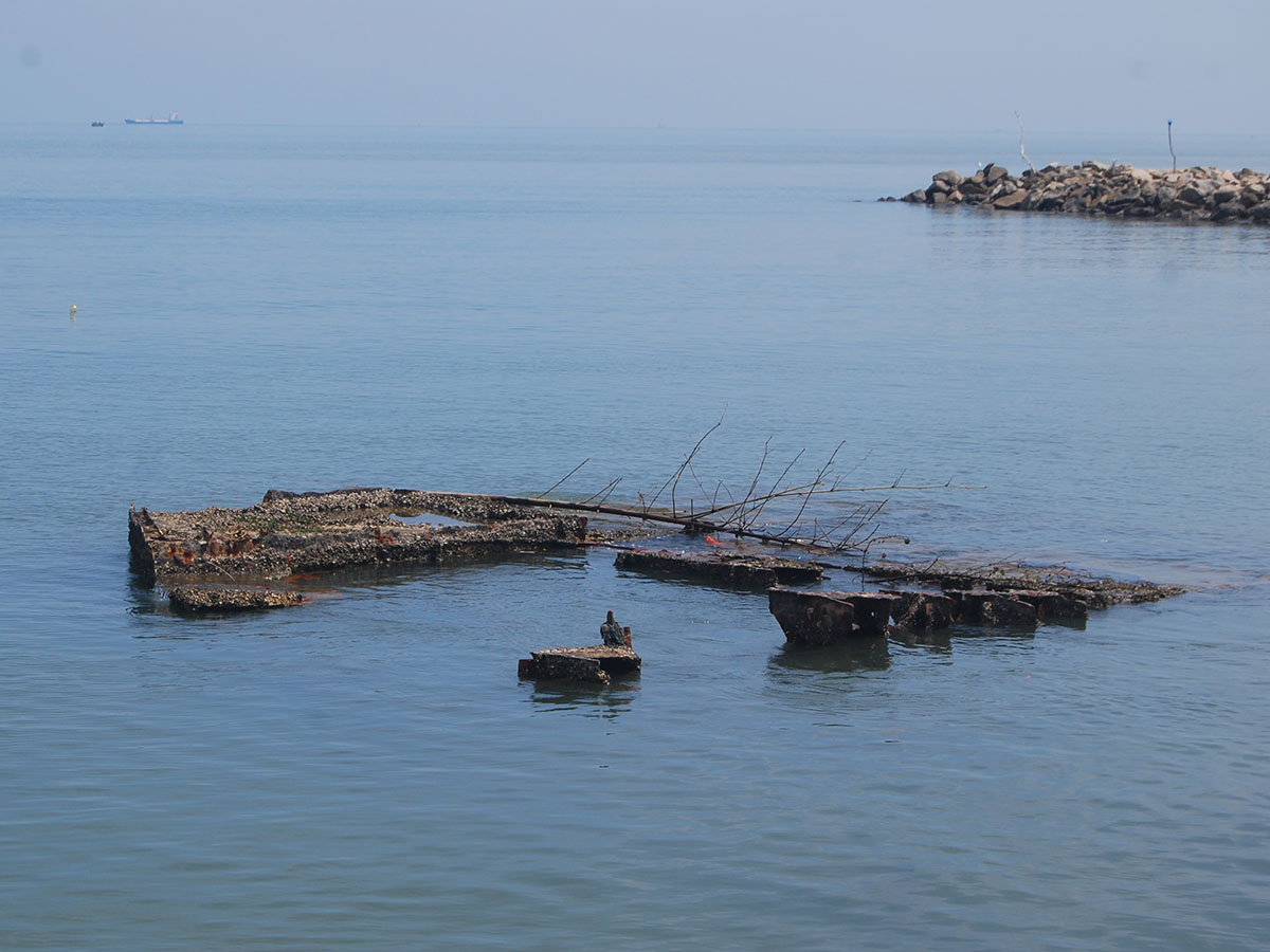
The Modara Barge represents the remnants of a utility barge that came to light during an Archaeological Impact Assessment (AIA) conducted by the Department of Archaeology. The wreck is situated in shallow waters in close proximity to the Modara fisheries harbor, allowing some parts of the barge to be visible above the sea level.
Based on the visible remains, the barge is estimated to have been approximately 15 meters in length. Unfortunately, the water surrounding the barge is heavily polluted and unhealthy for diving, making it unsafe to conduct underwater assessments or obtain accurate measurements of the wreck. Due to the presence of the Greater Colombo wastewater outlet flowing just 20 meters away from the barge, the area is deemed hazardous for diving and exploring.
Despite the challenges of accessing the wreck underwater, information about the sinking date remains elusive. While aware of the barge's presence, the local fishing community lacks a definitive understanding of when it was sunk. It appears that the barge was beached and abandoned long ago, left without maintenance, leading to its gradual deterioration and eventual wrecking.
There are many remains of boats, fishing gear, buoys and trash along the beach, making the whole area polluted. Most of this rubbish is from Colombo Harbour and from the residents of the fisheries harbour area. The remains of the utility barge silently narrate a story of time and neglect, standing as a reminder of the complex relationship between human activity and the marine environment.
Media gallery
·
Location
District: Colombo
Province: Western
Depth profile
0–2 m
Protection & status
- Access
- None
- Legal status
- None
- Archaeological value
- Low
- Physical protection
- None
- Degradation
- Corrosion
- Degradation
- Fragile
- Owner terrain
- Dept of Archaeology
- Owner site
- Department of Archaeology
- Authority
- DOA & MAU-CCF
- Threat
- Deterioration
Related shipwrecks
.jpg)
03 km west of Panadura
Panadura Boiler Wreck 01 (Southwest Wreck)
Nilkete Wreck 01
SL/W/PANA/M/01
- District
- Colombo
- Depth
- 5–15 m
.jpg)
3.4 km south west of Panadura
Panadura Boiler Wreck 02 (Northeast Wreck)
Nilkete Wreck 02
SL/W/PANA/M/02
- District
- Colombo
- Depth
- 5–15 m
.jpg)
2 Km West Of Moratuwa
Moratuwa Gun Boat
Chevron(?) Patrol Craft
SL/W/COLO/M/03
- District
- Colombo
- Depth
- 12–14 m
.jpg)
4 Km West Of Lunawa
MV Thermopylae Sierra
Sierra
SL/W/COLO/M/04
- District
- Colombo
- Depth
- 6–23 m