

Hambantota
Niyandagala Wreck
SL/S/GODA/M/07
- Period
- Colonial - British
- District
- Hambantota
- Depth
- 5.00–18.00 m
- Vessel type
- Iron Hull, Steam Ship, Bulk Carrier
Overview
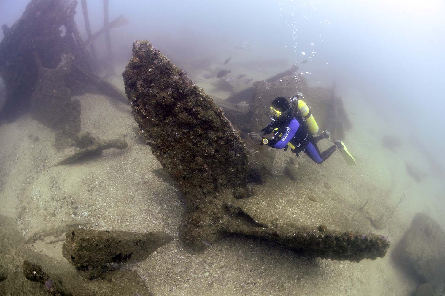
The Niyandagala Wreck is a large unidentified steamer that met its fate on the Niyandagala reef, situated near the Godawaya fishing village. The ship's name and origin remain a mystery. The site was known to local divers and fishermen as the Niyandagala wreck, suggesting that the ship may have struck the shallow reef, which is also known as Niyanda gala or the Niyanda reef.
Before the year 2004, a local salvage group partially salvaged the wreck. However, substantial portions of the ship's structure still remain scattered among the rocks. Notably, large boilers can be found on the shallow area of the reef, with depths less than 5 meters. As divers venture deeper, the wreck descends to approximately 18 meters, where the stern end lies. The site offers a diverse marine ecosystem, attracting a wide array of marine life due to the remains providing shelter and habitat.
Exploring the Niyandagala Wreck is best during the Northeast monsoon, as favorable sea conditions make the site accessible and safer for visits. Divers and marine enthusiasts can appreciate the biodiversity thriving in and around the wreck, creating a unique and enriching underwater experience.
The age of the Niyandagala Wreck is estimated to be over a century due to the condition of the remains and the absence of modern features. Despite the wreck's intriguing historical background, no artifacts or objects can be seen at the wrecksite, leaving its true identity and purpose shrouded in uncertainty.
As the Niyandagala Wreck stands as an enigma from the past, it continues to be a captivating site for those who venture into the depths to uncover its hidden stories and the secrets it guards beneath the waves.
Media gallery
·
Location
District: Hambantota
Province: Southern
Depth profile
5–18 m
Protection & status
- Access
- None
- Legal status
- None
- Archaeological value
- Medium
- Physical protection
- None
- Degradation
- Corrosion
- Owner terrain
- Dept of Archaeology
- Owner terrain
- Sri Lanka Navy
- Owner site
- Department of Archaeology
- Owner site
- Sri Lanka Navy
- Authority
- DOA & MAU-CCF
- Authority
- Sri Lanka Navy
- Threat
- Looting
- Threat
- Deterioration
Related shipwrecks
.jpg)
15 Km west Of Colombo
SS Worcestershire
Bamba Wisi Haye Nawa
SL/W/COLO/M/07
- Period
- 1 st World War
- District
- Colombo
- Depth
- 50–60 m
.jpg)
17 Km west of Colombo
SS Perseus
Athnagulpita Nava
SL/W/COLO/M/15
- Period
- 1 st World War
- District
- Colombo
- Depth
- 35–40 m
.JPG)
06 km West of Negombo
Musgrave (1885)?
Negombo Shallow Wreck
SL/W/NEGO/M/25
- Period
- Colonial - British
- District
- Gampaha
- Depth
- 8–11 m
.JPG)
NSD-0039
SS Ava
Irakkandi Wreck
SL/E/IRAK/M/01
- Period
- Colonial - British
- District
- Trincomalee
- Depth
- 6–9 m