

Galle
Site S or Boiler wreck 01
SL/S/GHRB/M/12
- Period
- Colonial - British
- District
- Galle
- Depth
- 9.00–13.00 m
- Vessel type
- Steam Ship, Bulk Carrier
Overview
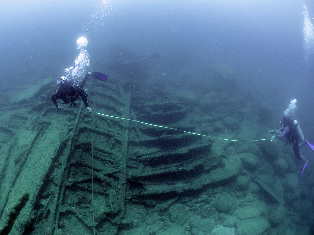
The enigmatic Galle Harbour Boiler Wreck 01 is an unidentified steamship situated within the Galle Harbour, specifically on the west side of the approach channel or fairway. Its discovery dates back to the Galle Harbour project conducted from 1992 to 1998 when side scan sonar exploration revealed its presence. The site was named as GHS. The wreck was subsequently noted again during an Archaeological Impact Assessment (AIA) conducted in 2007 by the Department of Archaeology with technical assistance from the Western Australian Museum.
The wreck lies scattered over a small reef at a depth of approximately 12 meters, offering glimpses into its intriguing history. Evidently, the ship deviated from the approach channel, leading to a collision with the shallow reef. The aftermath of this event saw significant salvaging efforts, resulting in the majority of the iron hull and superstructure being removed. However, two boilers remain at the midship area, providing insights into the ship's propulsion system.
Continuing along the wreck, one can observe the intact shaft, propeller, rudder, and aperture located at the stern end, resting on a sandy seabed. As one moves towards the amidships to the bow, the reef becomes the platform for the remnants of the ship, offering a view of the heavily damaged bow section, with remains scattered in various directions.
In 2012, the Maritime Archaeology Unit conducted comprehensive measurements and recordings of the wreck, capturing its dimensions and features in detail. The site features an array of artifacts, including bricks, remnants of bottles, and iron objects, providing tantalizing glimpses into the ship's past.
The surrounding area of the wreck is teeming with marine life, creating a thriving ecosystem. This biodiversity attracts fishing activities, as evidenced by fragments of nylon ropes, fishing nets, and garbage found at the shipwreck site.
Media gallery
·
Location
District: Galle
Province: Southern
Depth profile
9–13 m
Protection & status
- Access
- Yes
- Legal status
- None
- Archaeological value
- Medium
- Physical protection
- None
- Degradation
- Corrosion
- Degradation
- Fragile
- Owner terrain
- Dept of Archaeology
- Owner site
- Department of Archaeology
- Owner site
- Sri Lanka Navy
- Authority
- DOA & MAU-CCF
- Authority
- Sri Lanka Navy
- Threat
- Looting
- Threat
- Deterioration
Related shipwrecks
.jpg)
15 Km west Of Colombo
SS Worcestershire
Bamba Wisi Haye Nawa
SL/W/COLO/M/07
- Period
- 1 st World War
- District
- Colombo
- Depth
- 50–60 m
.jpg)
17 Km west of Colombo
SS Perseus
Athnagulpita Nava
SL/W/COLO/M/15
- Period
- 1 st World War
- District
- Colombo
- Depth
- 35–40 m
.JPG)
06 km West of Negombo
Musgrave (1885)?
Negombo Shallow Wreck
SL/W/NEGO/M/25
- Period
- Colonial - British
- District
- Gampaha
- Depth
- 8–11 m
.JPG)
NSD-0039
SS Ava
Irakkandi Wreck
SL/E/IRAK/M/01
- Period
- Colonial - British
- District
- Trincomalee
- Depth
- 6–9 m